Illustrative example · NS-T5 (Near Southside, §4.1305)
Land & development feasibility

See the building before you buy the dirt.

Proper Plans reads a parcel's zoning, site, market and cost picture, underwrites what can actually be built there, from a backyard ADU to a five-story mixed-use building, and tells you whether the deal pencils.

Illustrative example · NS-T5 (Near Southside, §4.1305)

FROM PARCEL TO BUILDING ↓
Public data attached to every studyUSGSFEMA NFHLUSFWS NWIU.S. Census ACS·Underwriting standard published →
Illustrative example · not a real parcel
01 · SiteBot · LandBot

It starts with the lot.

A half-acre parcel: property lines, setbacks, the street and the zoning district. Public layers attach to the study automatically.

02 · ZoningBot · HBUBot

The zoning draws the blueprint.

Build-to line, height in stories, parking behind: the site plan follows the code, then the floor plates stack to what it allows.

03 · ConstructBot · BidBot

Five stories, floor by floor.

Retail on the ground floor and about 40 apartments above, costed by trade from the structure up.

04 · FinBot · RiskBot · ReportBot

Then see what you'd build.

The finished building, a pro forma, a scored risk register and a verdict: GO, CONDITIONAL GO or NO-GO.

Illustrative render · NS-T5 (Near Southside, §4.1305)
How it works

Four questions, answered in order.

Every study follows the same path a development team would, with a named analyst at each step, so you can see where a verdict came from.

01 · Parcel SiteBot · LandBot

Site profile, terrain, soils, utilities and access, plus flood, wetlands and census layers.

02 · Envelope ZoningBot · HBUBot

Uses, density, height, setbacks and parking, then the four highest & best use tests.

03 · Structure ConstructBot · BidBot

Budget by trade, bid leveling, and quantity takeoffs proposed from plan PDFs for a person to accept.

04 · Verdict FinBot · RiskBot · ReportBot

Pro forma, risk register and a GO, CONDITIONAL GO or NO-GO verdict with an action plan.

The lot, in layers

Public data, already on the map.

Before any analyst writes a word, Proper Plans attaches the public layers for the parcel to the study.

ParcelYour address, geocoded to its jurisdiction.
USGS terrainElevation and topography for buildability.
FEMA NFHL flood zonesNational Flood Hazard Layer designations.
USFWS wetlandsNational Wetlands Inventory mapped wetlands.
Census ACS tractPopulation, income and housing for the tract.
SUBJECT PARCEL

Illustrative map. The layers are the public sources Proper Plans attaches; the geometry is not a real parcel.

Explore the model

Turn it around. Peel it back.

Demonstration buildings on illustrative Dallas, Fort Worth and Denton sites, each checked against the cited official code. Drag to orbit, scroll or pinch to zoom, toggle the site, zoning envelope, structure, systems and finishes, and tap a marker to see which analyst checks that part of the deal.

Drag · Zoom · Tap a marker

Illustrative demonstration site — parcel not verified against zoning maps. Model generated in code.

Immersive

Walk the site before it exists.

The model above is the same in the browser, on your phone and in a headset. Here is exactly what works today, and what doesn't yet.

Live

View in AR

Place the mixed-use building or a single-family house on a table or the ground with your phone camera. Android uses Scene Viewer; iPhone and iPad use AR Quick Look with a .usdz model.

Live

View in VR

Open this page in a headset browser (Meta Quest Browser, Safari on Apple Vision Pro) and press View in VR. Stand on the street, behind the building or at the corner of any of the demonstration examples; switch to a table-top model, swap buildings and toggle the same layers with your controller.

Live in the Deal Desk

Takeoffs from plans

Upload a plan PDF to a deal and the AI proposes a quantity takeoff for a person to review and accept.

Coming soon

Your own project in AR / VR

Viewing a building generated from your own plans or study in AR and VR is not in the product yet.

DFW examples, checked against the code

Real code. Real write-ups.

Each building above sits on an illustrative Dallas, Fort Worth or Denton site. Write-ups cite the official ordinance. The commercial, mixed-use, apartment and home-plus-ADU memos were produced by production ZoningBot on November 11, 2026 and fact-checked; the duplex and triplex memos were written from the cited official code the same day.

Illustrative demonstration site — parcel not verified against zoning maps.

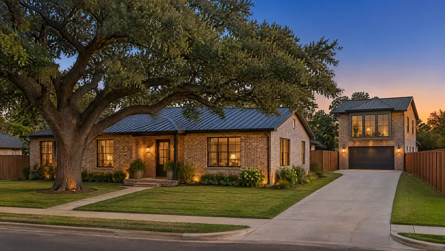
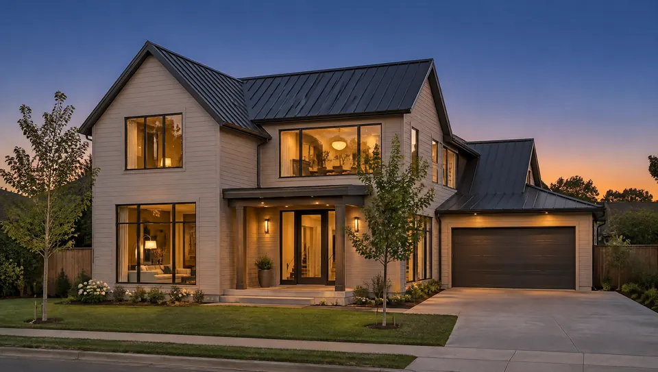
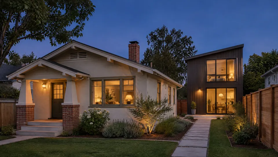
Illustrative dusk render: House + 750 sq ft garage ADU, south of the Downtown Square, DentonIllustrative · demonstration site
Home + ADU · Denton, TX

House + 750 sq ft garage ADU

south of the Downtown Square, Denton · R6, § 3.2.6 / Figure 3.2-F (R6) and Subsection 5.4.4 (ADU)

ZoningBot: Low risk. One detached ADU appears allowed by right with a building permit; no Specific Use Permit unless it is a second ADU. 750 sq ft is under the cap (about 1,350 sq ft for an 1,800 sq ft house), and house plus ADU is about 2,550 sq ft against roughly 4,320 sq ft of allowed coverage. No ADU parking is required.

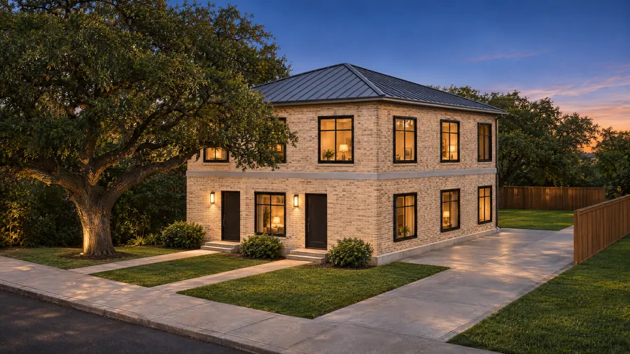
Illustrative dusk render: 2-story, 2-unit duplex, North Oak Cliff, west of I-35E, DallasIllustrative · demonstration site
Duplex · Dallas, TX

2-story, 2-unit duplex

North Oak Cliff, west of I-35E, Dallas · D(A), § 51A-4.113 (D(A) Duplex)

ZoningBot: Low risk. A two-unit duplex appears allowed by right in D(A) with a building permit. The 7,200 sq ft lot meets the 6,000 sq ft minimum, and a two-story building is under the 36 ft height limit and well under 60% coverage. Two at-grade spaces match the published 1-space-per-unit ratio.

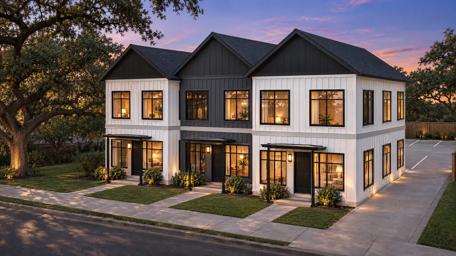
Illustrative dusk render: 2-story, 3-unit triplex, east of the Downtown Square, DentonIllustrative · demonstration site
Triplex · Denton, TX

2-story, 3-unit triplex

east of the Downtown Square, Denton · R7, § 3.2.7 / Figure 3.2-G (R7) and Table 5.2-A (Triplex)

ZoningBot: Low risk. A triplex appears allowed by right in R7 with a building permit. The 8,750 sq ft lot exceeds the 4,000 sq ft, 50 ft and 80 ft minimums, and a two-story building is under the 40 ft height limit and well under 65% coverage. Six rear spaces match the published 2-spaces-per-unit ratio.

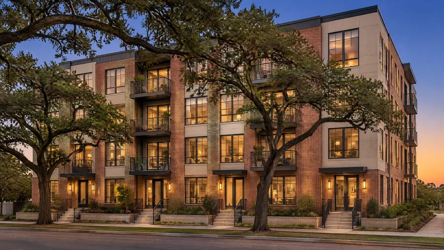
Illustrative dusk render: 4-story, 36 apartments, Live Oak / Gaston corridor, Old East DallasIllustrative · demonstration site
Apartments · Dallas, TX

4-story, 36 apartments

Live Oak / Gaston corridor, Old East Dallas · MF-3(A), § 51A-4.116(c) (MF-3(A))

ZoningBot: Low to Medium risk. 36 units on 0.45 acres is about 80 units per acre against a 90 cap, and the 2.0 FAR allows roughly 39,200 sq ft. Permitted by right with a site plan and building permit. Under the May 2025 parking reform, the likely requirement is 0.5 space per unit (about 18) plus guest parking, or none within ½ mile of DART rail, pending the codified text.

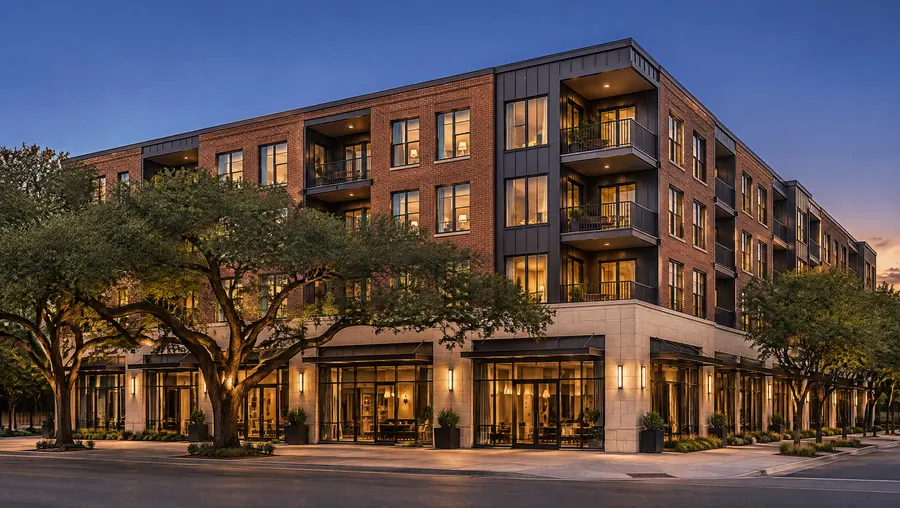
Illustrative dusk render: 5-story retail + about 40 apartments, West Magnolia, Near Southside, Fort WorthIllustrative · demonstration site
Mixed-use · Fort Worth, TX

5-story retail + about 40 apartments

West Magnolia, Near Southside, Fort Worth · NS-T5, § 4.1305 (Near Southside, NS-T5)

ZoningBot: Low to Medium (provisional) risk. Five stories fit the NS-T5 base height, and density is unrestricted. It is a form-based approval: the project needs a Certificate of Appropriateness before a building permit, approved by the Director if it conforms and by the Urban Design Commission if it deviates. Under NS-T4-N it would fail.

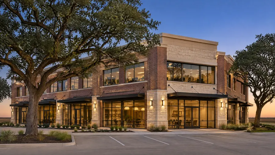
Illustrative dusk render: 2-story retail + office, Arlington Heights, Fort WorthIllustrative · demonstration site
Commercial · Fort Worth, TX

2-story retail + office

Arlington Heights, Fort Worth · E, § 4.901 (E, Neighborhood Commercial)

ZoningBot: Low risk. Likely allowed by right with a site plan and building permit; height and the 60,000 sq ft retail-footprint cap are comfortably met. The flagged risk is parking: about 32 retail + 20 office = 52 spaces before any reduction, which may not fit on 0.40 acres and could need a reduction, shared parking or a Board of Adjustment variance.

Renders are illustrative. Memos are planning-level analysis, not legal advice; zoning map designations are assumed and must be confirmed.

Residential

Homes, lot splits and the extra unit.

For home builders and residential investors: pick Residential on a new study and ten analysts work the lot, from what the zoning allows to what it costs to build and whether it pencils. Rentals from a single-family home to a fourplex underwrite on the Deal Desk Tear Sheet.

Illustrative renders. Not real projects.

01 · The lotWhat the zoning allows

Uses, density, height, setbacks and parking for the zoning you enter, plus HOA or deed restrictions you add. Anything it can't confirm is flagged.

02 · The groundSite and utilities

Flood zone, wetlands, terrain and census data attach automatically; soils, access, clearing and utility extensions are weighed.

03 · The buildCost by trade

A construction budget by trade, bid leveling across builders, and takeoffs proposed from your plan PDFs in the Deal Desk.

04 · The answerGO or NO-GO

A pro forma for sale, refinance or hold, a scored risk register, and a verdict with what to verify before you close.

Run a residential studySee the house + ADU in 3D
The analysts

The right analysts for the asset.

Pick an asset class and Proper Plans runs the analysts that fit it. Each is an AI module focused on one question, and each one's findings are in the report.

Site & entitlements

SiteBotSite profile from your inputs and the public data layers
ZoningBotPermitted uses, density, height, setbacks, parking, entitlement path
HBUBotHighest & Best Use: the four tests
LandBotTopography, soils, utilities, access, site work

Market & cost to build

MarketBotDemographics, demand drivers, supply pipeline, rents
ConstructBotConstruction budget by trade
BidBotBid leveling across contractor bids
OffMarketBotOff-market acquisition strategy for a target market

Finance, risk & report

FinBotDevelopment pro forma, sources & uses, returns
RiskBotRisk register scored by likelihood × impact
ReportBotMaster feasibility report and verdict
DeckBot12-slide investor presentation outline

Asset-class specialists

MixedUseBot · RetailBot · IndustrialBotUse-specific programming, trade area and logistics analysis
PowerBot · FiberBot · CoolBotData center power, connectivity and cooling
DCZoningBot · DCFinBotData center permitting and pro forma
DCSiteBotData center site scorecard
Raw Land · 7 analystsResidential · 10 analystsMultifamily · 10 analystsMixed-Use · 11 analystsCommercial / Retail · 11 analystsIndustrial / Logistics · 11 analystsData Center · 11 analystsMaster Planned Community · 13 analysts
The product

The Deal Desk, as it is.

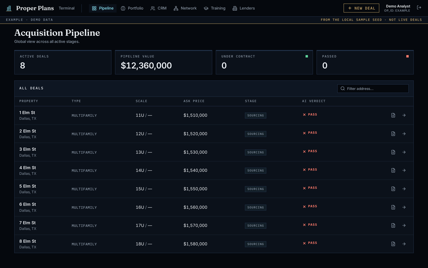
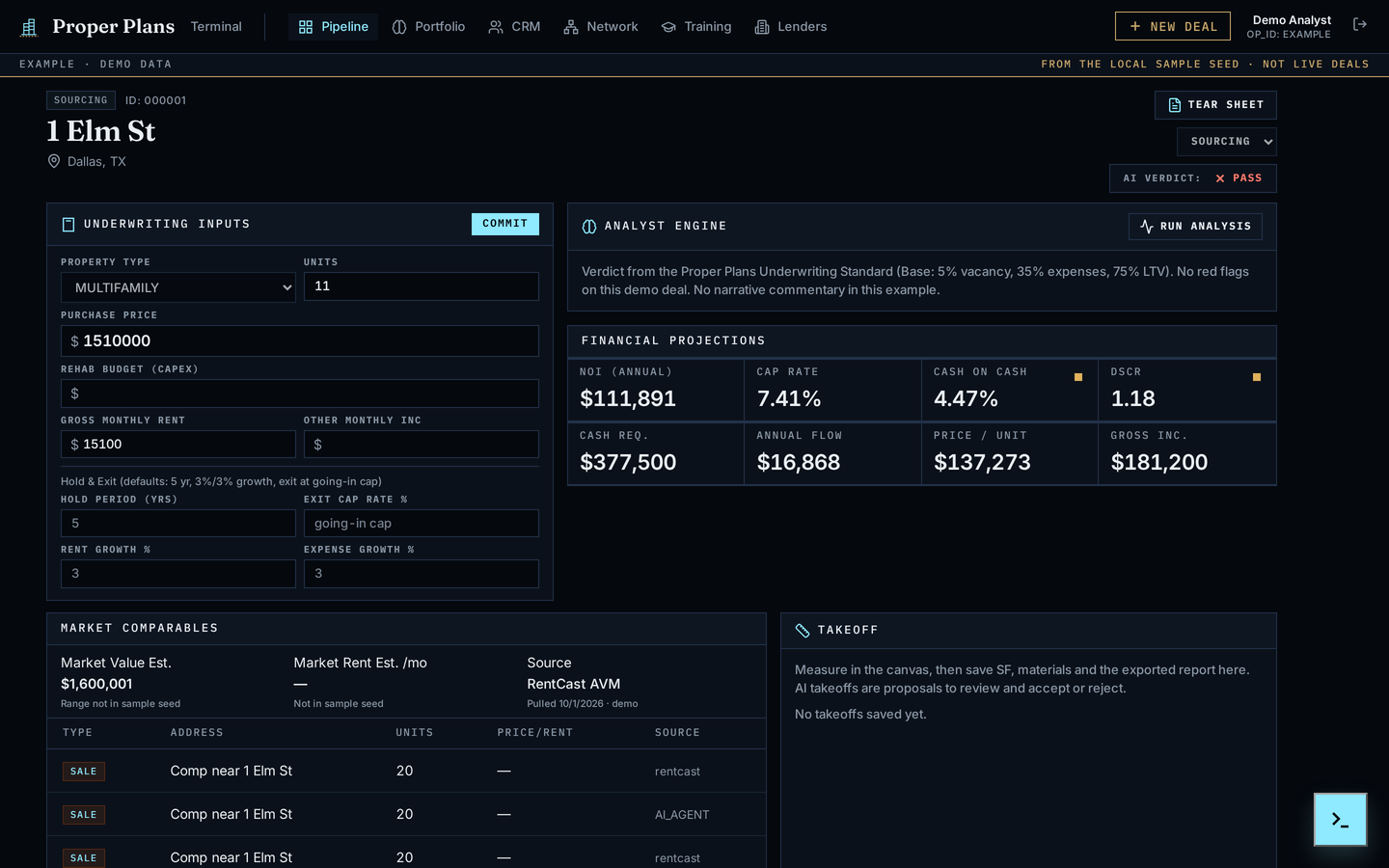
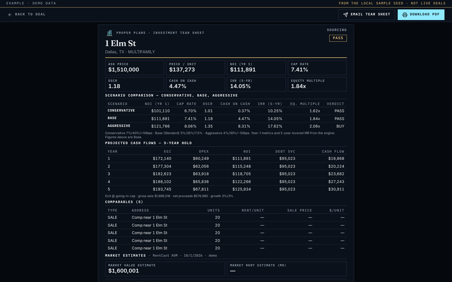
Product screens shown with demo data: the pipeline, a deal with its underwriting, and the three-scenario Tear Sheet.

Proper Plans Deal Desk pipeline with demo deals
PipelineEvery deal by stage, with its verdict and numbers.
A demo deal in the Deal Desk
DealMetrics, comps, takeoffs and the deal chat.
Three-scenario Tear Sheet for a demo deal
Tear SheetConservative, Base, Aggressive.

Product screens shown with demo data. Addresses and figures are examples, not real deals.

The report

One verdict, and every reason for it.

An overall score out of 100, the score from each analyst, key findings, a scored risk register, an action plan, and a GO, CONDITIONAL GO or NO-GO verdict. Share it with a read-only link.

Open the sample report
MASTER FEASIBILITY REPORT · SAMPLE DATA

2847 N 43rd Ave, Phoenix AZ

Multifamily · 18 units · value-add
77
OVERALL / 100
GO
SiteBot78
ZoningBot71
HBUBot74
MarketBot84
FinBot76
RiskBot69

Verdict GO. Proceed with standard due diligence.

Illustrative example with sample data. Not a real analysis or recommendation.

Examples

How people use it.

Walkthroughs built only on what the product does today.

Single-family homes

Single-family: build it, sell it, or hold it?

READ THE WALKTHROUGH →
  1. New studyEnter the address, pick Residential, and add the lot size, price, zoning and the home you plan to build.
  2. Ten analystsSite, zoning, highest & best use, market, land, construction, bids, finance, risk and report run on the lot.
  3. Check the buildReview the budget by trade and level your builders’ bids.
  4. VerdictA master report with a verdict, a scored risk register and what to verify before you close.
Small multifamily & ADUs

Duplex to fourplex, or a backyard ADU: does the extra unit pay?

READ THE WALKTHROUGH →
  1. New dealAdd the address, property type (SFR to quad), units, price, rents and rehab or build budget in the Deal Desk.
  2. UnderwriteThe Tear Sheet runs three scenarios on the Proper Plans Underwriting Standard: 5% vacancy, 35% expense ratio, 75% LTV.
  3. Red flagsCapex above 40% of price or an expense ratio under 20% is flagged.
  4. Lenders & shareMatch lenders, then send a read-only report link to a partner or lender.
Value-add multifamily

Multifamily: does it pencil at the asking price?

READ THE WALKTHROUGH →
  1. New dealAdd the address, price, rents and rehab budget in the Deal Desk.
  2. UnderwriteThe Tear Sheet runs Conservative / Base / Aggressive at 5% vacancy, 35% expense ratio, 75% LTV.
  3. Red flagsCapex above 40% of price or an expense ratio under 20% is flagged.
  4. ShareSend a read-only report link to a partner or lender.
Raw land

Raw land: should I tie this up?

READ THE WALKTHROUGH →
  1. AddressEnter the parcel and pick Raw Land.
  2. Public layersUSGS, FEMA, USFWS wetlands and Census data attach automatically.
  3. Seven analystsSite, zoning, HBU, land, finance, risk and report.
  4. What to verifyAn action plan of what to confirm before you commit.
Retail & mixed-use

Retail & mixed-use: trade area, access and use permissions

READ THE WALKTHROUGH →
  1. New studyEnter the address and pick Commercial / Retail or Mixed-Use.
  2. Analysts runSite, zoning, market, cost and use-specific analysts run in parallel.
  3. RisksRiskBot scores each risk by likelihood and impact.
  4. ReportA master report with a verdict and action plan.
Data center site

Data centers: is there power, fiber and a path to permit?

READ THE WALKTHROUGH →
  1. Pick Data CenterChoose the asset class on a new study.
  2. Specialists runPower, fiber, cooling, zoning and finance analysts run alongside SiteBot, ZoningBot and HBUBot.
  3. ScorecardDCSiteBot synthesises a site scorecard; RiskBot builds the risk register.
  4. VerdictReportBot issues GO, CONDITIONAL GO or NO-GO.
Methodology

Numbers you can check.

The Deal Desk underwrites on a published standard. Change the deal, not the rules.

Vacancy
5%

Base case.

Expense ratio
35%

Of effective gross income.

Financing
75% LTV

7.5% rate, 30-year amortization.

Red flags
>40%

Capex vs price flagged; expense ratio under 20% flagged as too good to be true.

AI can make mistakes and public data can be out of date. Proper Plans is a first pass: confirm material findings with the jurisdiction and licensed professionals. Full methodology · Disclaimer

Pricing

Start free.

SEE FULL PRICING →
Free
$0

1 full study, every analyst for the asset class, the master report and a share link.

Pro
$99 / month

Unlimited studies, comparisons and share links.

Enterprise · Developers & Funds
Talk to us

Multiple seats and volume. Contact us.

FAQ

Questions, answered

What does Proper Plans actually analyze?

You pick an asset class and Proper Plans runs the analysts that fit it, from 7 for raw land to 13 for a master-planned community: site, zoning and highest & best use, land, market, construction cost, finance, risk and report, plus specialists for retail, industrial, mixed-use and data centers. The master report ends with a GO, CONDITIONAL GO or NO-GO verdict, risks and an action plan.

Does it work for houses, lot splits and ADUs?

Yes. Pick Residential for a single-family lot, a lot split or an ADU and ten analysts run, from zoning and site to cost to build, finance and risk. The Deal Desk underwrites single-family, duplex, triplex, fourplex and small multifamily rentals on a three-scenario Tear Sheet. Always confirm lot-size, ADU and subdivision rules with your jurisdiction.

Where does the data come from?

Proper Plans automatically attaches public sources such as USGS, FEMA flood maps (NFHL), the USFWS National Wetlands Inventory and U.S. Census ACS, and combines them with the deal inputs you provide. See Data & Methodology.

Is this a replacement for consultants?

No. Proper Plans is a fast first pass that helps you decide which sites deserve deeper diligence. Always verify findings with licensed local professionals.

How much does it cost?

Your first full study is free with no credit card. Pro is $99 per month for unlimited studies. Developers and funds with volume needs can talk to us.

Can I share reports?

Yes. Create a read-only share link for any report and revoke it anytime.

Can I see the building in AR or VR?

Yes, the demonstration building on this site can be placed in AR on your phone or walked around in a VR headset browser. Viewing your own uploaded plans in AR/VR is not available yet.

Your next site

See it before you buy it.

Your first full study is free. No credit card required.

Run a studyExplore the model